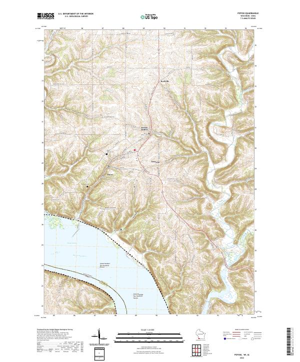
2022 Map of Potosi
USGS Topo · Published 2022About this map
The Potosi area of Grant County, Wisconsin, sits at a unique geographical and political crossroads where the Mississippi River meets the driftless bluffs of the Midwest. The landscape is defined by deep, winding hollows such as Graham Hollow and Yankee Hollow that drop toward the river valley. The 2022 survey detail shows a cluster of historic lead-mining era settlements including British Hollow, Tennyson, and Rockville, each maintaining its distinct identity along the ridge-and-valley road network. The map also records several local burial sites, such as Saint Thomas Cem and British Hollow Cem, which are vital for genealogical research in this long-settled region. Waterways like the Platte River and the engineered Potosi Canal highlight the historical reliance on river transport, while Island Number Two Hundred Eleven marks the shifting boundary between Wisconsin and Iowa.
Find a feature on this map
92 named features on this map. Tap any name to fly to it.
Don’t see what you’re looking for? This feature index may not catch every label — zoom into the map to look around manually.
Map Details
Editions of this 2022 Potosi Map
This is the sole edition of this map. No revisions or reprints were ever made.
Other maps of this area

1900 · Lancaster
USGS Topo · 1:125,000

1904 · Lancaster
USGS Topo · 1:125,000

1908 · Lancaster
USGS Topo · 1:125,000

1955 · Balltown
USGS Topo · 1:24,000

1956 · Dubuque North
USGS Topo · 1:24,000

1956 · Sherrill
USGS Topo · 1:24,000

1957 · Potosi
USGS Topo · 1:24,000

1959 · Dubuque
USGS Topo · 1:250,000

1961 · Dubuque
USGS Topo · 1:250,000
1961 · Dickeyville
USGS Topo · 1:24,000