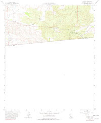
1960 Map of Potrero
USGS Topo · Published 1982About this map
Big Potrero Valley dominates this high-desert landscape in southern San Diego County, where the settlement of Potrero serves as a hub for local ranching and transit. This 1960 field-checked survey reveals a rugged borderland defined by the winding course of Potrero Creek and the steep slopes of Hauser Mountain. The map provides a critical look at the international boundary between the United States and Mexico, showing the close proximity of the border to the town of Tecate.
Find a feature on this map
19 named features on this map. Tap any name to fly to it.
Don’t see what you’re looking for? This feature index may not catch every label — zoom into the map to look around manually.
Map Details
Editions of this 1960 Potrero Map
4 editions found
Other maps of this area

1903 · Cuyamaca
USGS Topo · 1:125,000

1904 · Southern California Sheet No. 2
USGS Topo · 1:250,000

1931 · Carrizo
USGS Topo · 1:125,000

1939 · Campo
USGS Topo · 1:62,500

1942 · Potrero
USGS Topo · 1:48,000

1942 · Campo
USGS Topo · 1:62,500

1944 · Potrero
USGS Topo · 1:62,500

1950 · San Diego
USGS Topo · 1:250,000

1954 · San Diego
USGS Topo · 1:250,000

1955 · San Diego
USGS Topo · 1:250,000