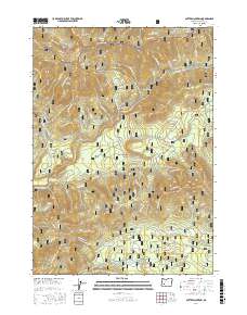
2017 Map of Potter Mountain
USGS Topo · Published 2017About this map
Umpqua Hot Springs sits at the heart of this high-elevation forest landscape, where the N Umpqua River and Clearwater River cut through the volcanic terrain of the Cascades. The map documents a complex network of forest development roads and industrial infrastructure, including the Lemolo Number 2 Canal and the Clearwater Number One Forebay, illustrating the region's role in hydroelectric power generation. Prominent geological features like Potter Mountain and the ominously named Dread and Terror Ridge define the local topography. This era of forest management is reflected in the numerous timber-related labels such as Pot Thinning TS and Loafer Thin TS, which point to active silviculture within the Willamette National Forest and Umpqua National Forest. Smaller clearings and meadows like Thorn Prairie and Upper Mountain Meadows provide distinct breaks in the dense canopy coverage.
Find a feature on this map
82 named features on this map. Tap any name to fly to it.
Don’t see what you’re looking for? This feature index may not catch every label — zoom into the map to look around manually.
Map Details
Editions of this 2017 Potter Mountain Map
This is the sole edition of this map. No revisions or reprints were ever made.
Other maps of this area

1917 · Diamond Lake
USGS Topo · 1:125,000

1956 · Toketee Falls
USGS Topo · 1:62,500

1956 · Diamond Lake
USGS Topo · 1:62,500

1956 · Summit Lake
USGS Topo · 1:62,500

1956 · Garwood Butte
USGS Topo · 1:62,500

1958 · Roseburg
USGS Topo · 1:250,000

1959 · Roseburg
USGS Topo · 1:250,000

1978 · Diamond Lake
USGS Topo · 1:100,000
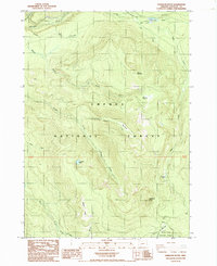
1985 · Garwood Butte
USGS Topo · 1:24,000
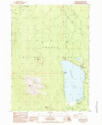
1985 · Diamond Lake
USGS Topo · 1:24,000