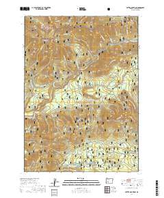
2020 Map of Potter Mountain
USGS Topo · Published 2020About this map
Umpqua Hot Springs and the surrounding high-elevation terrain of the Cascades dominate this 2020 topographic record of Douglas County. The landscape is defined by the canyon of the N Umpqua River and its complex network of tributaries, including Loafer Cr and Potter Cr. High ridges and peaks such as Potter Mtn, Watson Butte, and the ominous Dread and Terror Ridge provide a glimpse into the steep vertical relief of the Umpqua National Forest.
Find a feature on this map
60 named features on this map. Tap any name to fly to it.
Don’t see what you’re looking for? This feature index may not catch every label — zoom into the map to look around manually.
Map Details
Editions of this 2020 Potter Mountain Map
This is the sole edition of this map. No revisions or reprints were ever made.
Other maps of this area

1917 · Diamond Lake
USGS Topo · 1:125,000

1956 · Toketee Falls
USGS Topo · 1:62,500

1956 · Diamond Lake
USGS Topo · 1:62,500

1956 · Summit Lake
USGS Topo · 1:62,500

1956 · Garwood Butte
USGS Topo · 1:62,500

1958 · Roseburg
USGS Topo · 1:250,000

1959 · Roseburg
USGS Topo · 1:250,000

1978 · Diamond Lake
USGS Topo · 1:100,000
1985 · Garwood Butte
USGS Topo · 1:24,000
1985 · Diamond Lake
USGS Topo · 1:24,000