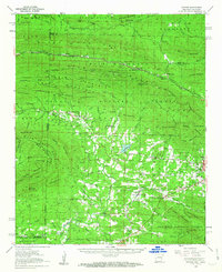
1958 Map of Potter
USGS Topo · Published 1963About this map
Wilhelmina State Park crowns the high ridges of Rich Mountain, where the Rich Mountain Lookout Tower stands as a sentinel over the Ouachita National Forest. This 1950s survey documents a landscape defined by the winding route of the Kansas City Southern railroad, which threads through the mountain gaps to serve small communities like Eagleton and Potter. The presence of numerous small cemeteries and rural churches, such as Mt Gillian Cem, Stinett Cem, and Center Point Ch, indicates a dispersed but established upland society centered on family landmarks and mountain faith.
Find a feature on this map
90 named features on this map. Tap any name to fly to it.
Don’t see what you’re looking for? This feature index may not catch every label — zoom into the map to look around manually.
Map Details
Editions of this 1958 Potter Map
3 editions found

Other maps of this area

1879 · Poteau Mountain
USGS Topo · 1:62,500

1887 · Poteau Mountain #1
USGS Topo · 1:62,500

1887 · Poteau Mountain #2
USGS Topo · 1:62,500

1890 · Poteau Mountain
USGS Topo · 1:125,000

1899 · Poteau Mountain
USGS Topo · 1:125,000

1900 · Winding Stair
USGS Topo · 1:125,000

1902 · Lukfata
USGS Topo · 1:125,000

1909 · Winding Stair
USGS Topo · 1:125,000

1913 · De Queen
USGS Topo · 1:125,000

1939 · Waldron
USGS Topo · 1:62,500