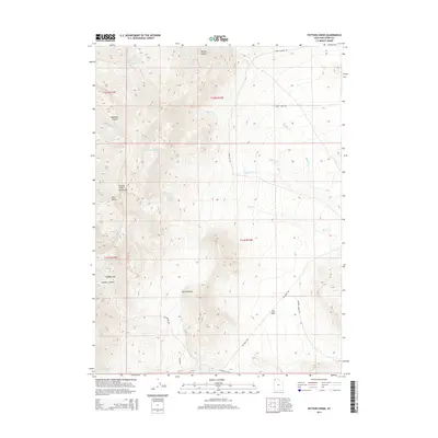
2014 Map of Potters Creek
USGS Topo · Published 2014About this map
Rosebud Spring and Sickle Spring provide critical water points in this arid corner of Box Elder County, situated along the eastern slopes of the Grouse Creek Mountains. The landscape is defined by deep drainages like Hubbard Canyon and Ingham Canyon, which feed into a complex system of seasonal waterways including Potters Cr, Birch Cr, and Cottonwood Cr. These creeks generally trend eastward toward the low-lying Dry Basin, illustrating the stark transition from high mountain peaks to the high desert floor.
Find a feature on this map
29 named features on this map. Tap any name to fly to it.
Don’t see what you’re looking for? This feature index may not catch every label — zoom into the map to look around manually.
Map Details
Editions of this 2014 Potters Creek Map
This is the sole edition of this map. No revisions or reprints were ever made.
Other maps of this area

1954 · Brigham City
USGS Topo · 1:250,000

1958 · Brigham City
USGS Topo · 1:250,000

1959 · Cotton Thomas Basin
USGS Topo · 1:62,500

1959 · Yost
USGS Topo · 1:62,500

1962 · Brigham City
USGS Topo · 1:250,000

1971 · Prohibition Spring
USGS Topo · 1:24,000

1971 · Emigrant Pass
USGS Topo · 1:24,000

1971 · Potters Creek
USGS Topo · 1:24,000
1971 · Rocky Pass Peak
USGS Topo · 1:24,000

1971 · Warm Spring Hills
USGS Topo · 1:24,000