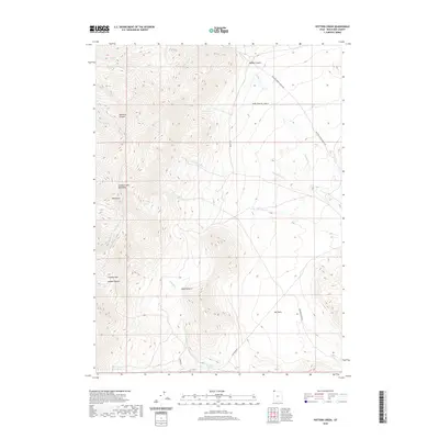
2020 Map of Potters Creek
USGS Topo · Published 2020About this map
Grouse Creek Mountains dominate this high-altitude terrain, where steep drainages and canyons carve into the landscape. This 2020 survey documents a network of seasonal watercourses including Potters Cr, Cottonwood Cr, and Birch Cr that flow eastward from the peaks toward the Dry Basin. The map shows the importance of water management and livestock grazing in this arid region, highlighted by named landmarks like Buck Pasture and vital water sources such as Rosebud Spring and Sickle Spring. Human presence is defined by a remote ranching infrastructure, with Meadow Springs Ranch Rd and Rosebud Spring Rd providing access to the high basins and canyons. The topography around Red Butte and Ingham Pass illustrates the challenging passage through this part of Box Elder County.
Find a feature on this map
23 named features on this map. Tap any name to fly to it.
Don’t see what you’re looking for? This feature index may not catch every label — zoom into the map to look around manually.
Map Details
Editions of this 2020 Potters Creek Map
This is the sole edition of this map. No revisions or reprints were ever made.
Other maps of this area

1954 · Brigham City
USGS Topo · 1:250,000

1958 · Brigham City
USGS Topo · 1:250,000

1959 · Cotton Thomas Basin
USGS Topo · 1:62,500

1959 · Yost
USGS Topo · 1:62,500

1962 · Brigham City
USGS Topo · 1:250,000

1971 · Prohibition Spring
USGS Topo · 1:24,000

1971 · Emigrant Pass
USGS Topo · 1:24,000

1971 · Potters Creek
USGS Topo · 1:24,000
1971 · Rocky Pass Peak
USGS Topo · 1:24,000

1971 · Warm Spring Hills
USGS Topo · 1:24,000