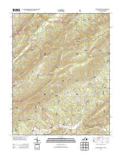
2013 Map of Potts Creek
USGS Topo · Published 2013About this map
Potts Creek lends its name to this mountain landscape along the Virginia-West Virginia border, where a complex network of ridges and watercourses defines the local geography. The area is marked by distinctive terrain features such as Middle Mountain, Potts Arm, and the dramatic Lovers Leap near Penny Hollow. In the western portion of the sheet, the Paint Bank National Fish Hatchery sits within Hanging Rock Valley, representing a significant local land use alongside the Steel Bridge Campground which provides river access. The map reveals an intricate drainage pattern, from the headwaters of Johns Creek and Potts Creek to numerous branches like Shawvers Run and Cold Spring Branch. Settlement remains sparse, concentrated primarily along valley corridors like Red Brush Valley and the roads following the creek beds, reflecting a rural character deeply tied to the underlying topography of the Appalachian ridges.
Find a feature on this map
41 named features on this map. Tap any name to fly to it.
Don’t see what you’re looking for? This feature index may not catch every label — zoom into the map to look around manually.
Map Details
Editions of this 2013 Potts Creek Map
This is the sole edition of this map. No revisions or reprints were ever made.
Other maps of this area

1887 · Lewisburg
USGS Topo · 1:125,000

1890 · Christiansburg
USGS Topo · 1:125,000

1891 · Lewisburg
USGS Topo · 1:125,000

1921 · Ronceverte
USGS Topo · 1:48,000

1923 · Ronceverte
USGS Topo · 1:62,500

1923 · Waiteville
USGS Topo · 1:62,500

1929 · Salem
USGS Topo · 1:48,000

1931 · Waiteville
USGS Topo · 1:48,000

1932 · Salem
USGS Topo · 1:62,500

1944 · Waiteville
USGS Topo · 1:62,500