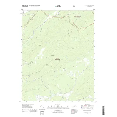
2019 Map of Potts Creek
USGS Topo · Published 2019About this map
Potts Creek flows through a deep valley along the border of Virginia and West Virginia, carving a path between Peters Mountain and Potts Mountain. This 2019 survey documents the rural character of the Alleghany, Monroe, and Craig county lines, where much of the land is preserved within the George Washington National Forest and the Jefferson National Forest. Small family cemeteries, including the Ruble Cem and Paxton Cem, are scattered across the slopes of Mid Mtn and the basins of the Red Brush Valley. The map highlights a landscape dominated by its ridges and hollows, where road networks like Potts Mnt Rd follow the natural topography. Significant drainages like Shawvers Run and Johns Creek define the lowlands, while landmarks such as Hanging Rock and Lovers Leap provide distinctive orientation points for the area.
Find a feature on this map
57 named features on this map. Tap any name to fly to it.
Don’t see what you’re looking for? This feature index may not catch every label — zoom into the map to look around manually.
Map Details
Editions of this 2019 Potts Creek Map
This is the sole edition of this map. No revisions or reprints were ever made.
Other maps of this area

1887 · Lewisburg
USGS Topo · 1:125,000

1890 · Christiansburg
USGS Topo · 1:125,000

1891 · Lewisburg
USGS Topo · 1:125,000

1921 · Ronceverte
USGS Topo · 1:48,000

1923 · Ronceverte
USGS Topo · 1:62,500

1923 · Waiteville
USGS Topo · 1:62,500

1929 · Salem
USGS Topo · 1:48,000

1931 · Waiteville
USGS Topo · 1:48,000

1932 · Salem
USGS Topo · 1:62,500

1944 · Waiteville
USGS Topo · 1:62,500