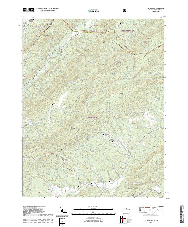
2022 Map of Potts Creek
USGS Topo · Published 2022About this map
Potts Mountain and the high ridges of the Jefferson National Forest dominate this landscape along the border of Virginia and West Virginia. The geography is defined by narrow valleys and steep mountain flanks, including Peters Mountain and Mill Ridge. Family legacies are deeply etched into the land, evidenced by numerous small burial grounds such as the Simpson Family Cem, Wilson Family Cem, and Nutter Family Cem scattered along the lower elevations.
Find a feature on this map
63 named features on this map. Tap any name to fly to it.
Don’t see what you’re looking for? This feature index may not catch every label — zoom into the map to look around manually.
Map Details
Editions of this 2022 Potts Creek Map
This is the sole edition of this map. No revisions or reprints were ever made.
Other maps of this area

1887 · Lewisburg
USGS Topo · 1:125,000

1890 · Christiansburg
USGS Topo · 1:125,000

1891 · Lewisburg
USGS Topo · 1:125,000

1921 · Ronceverte
USGS Topo · 1:48,000

1923 · Ronceverte
USGS Topo · 1:62,500

1923 · Waiteville
USGS Topo · 1:62,500

1929 · Salem
USGS Topo · 1:48,000

1931 · Waiteville
USGS Topo · 1:48,000

1932 · Salem
USGS Topo · 1:62,500

1944 · Waiteville
USGS Topo · 1:62,500