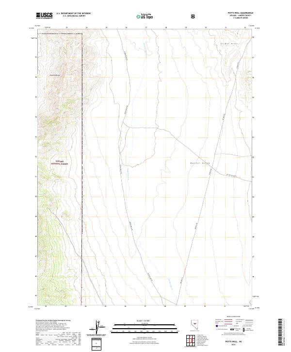
2021 Map of Potts Well
USGS Topo · Published 2021About this map
Monitor Valley and the Toquima Range define this high-altitude landscape in central Nevada, where the transition from basin floor to montane forest is clearly documented. The western portion of the map is dominated by the Toiyabe National Forest, marked by steep elevation gains and complex topography. In the lower-lying east, the ephemeral drainage of Stoneberger Cr threads through the valley, flanked by the Grimes Hills. Modern land use and access are represented by primitive routes like Grimes Ranch Rd and Belmont Rd, which trace the historical movement patterns of ranching and mining traffic between regional summits and valleys. This 2021 study captures the area's continued reliance on these secondary corridors for navigating the vast public lands and forest boundaries.
Find a feature on this map
14 named features on this map. Tap any name to fly to it.
Don’t see what you’re looking for? This feature index may not catch every label — zoom into the map to look around manually.
Map Details
Editions of this 2021 Potts Well Map
This is the sole edition of this map. No revisions or reprints were ever made.
Other maps of this area

1926 · Roberts Mountains
USGS Topo · 1:250,000

1929 · Roberts Mountains
USGS Topo · 1:250,000

1955 · Millett
USGS Topo · 1:250,000

1959 · Millett
USGS Topo · 1:250,000

1960 · Hickison Summit
USGS Topo · 1:62,500

1960 · Spencer Hot Springs
USGS Topo · 1:62,500

1960 · Dianas Punch Bowl
USGS Topo · 1:62,500

1960 · Wildcat Peak
USGS Topo · 1:62,500

1978 · Summit Mountain
USGS Topo · 1:100,000
1989 · White Sage Canyon
USGS Topo · 1:24,000