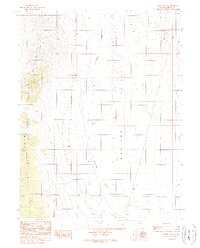
1989 Map of Potts Well
USGS Topo · Published 1990About this map
Monitor Valley defines the central geography of this high-desert landscape in central Nevada, situated between the uplift of the Toiyabe National Forest and the Grimes Hills. Compiled from photography and field checks in the late 1980s, the map provides a precise look at the arid valley floor, where seasonal drainage from Stoneberger Creek crosses the basin. Isolated water sources and human infrastructure are sparse, centered primarily on Potts Well and the nearby Monitor Well No 3, which served as critical points for ranching or transit in this open range. Small-scale industrial activity is evidenced by several Borrow Pits located near the southern boundary, likely used for local road maintenance or fill. The grid of section lines and townships underscores the administrative division of this public land, showing the intersection of the Toiyabe mountain front with the wide alluvial plains.
Find a feature on this map
12 named features on this map. Tap any name to fly to it.
Don’t see what you’re looking for? This feature index may not catch every label — zoom into the map to look around manually.
Map Details
Editions of this 1989 Potts Well Map
This is the sole edition of this map. No revisions or reprints were ever made.
Other maps of this area

1926 · Roberts Mountains
USGS Topo · 1:250,000

1929 · Roberts Mountains
USGS Topo · 1:250,000

1955 · Millett
USGS Topo · 1:250,000

1959 · Millett
USGS Topo · 1:250,000

1960 · Hickison Summit
USGS Topo · 1:62,500

1960 · Spencer Hot Springs
USGS Topo · 1:62,500

1960 · Dianas Punch Bowl
USGS Topo · 1:62,500

1960 · Wildcat Peak
USGS Topo · 1:62,500

1978 · Summit Mountain
USGS Topo · 1:100,000
1989 · White Sage Canyon
USGS Topo · 1:24,000