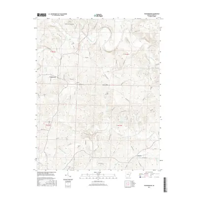
2017 Map of Poughkeepsie
USGS Topo · Published 2017About this map
Poughkeepsie and the surrounding rural landscapes of Sharp County are defined by the winding course of the Strawberry River and its numerous tributaries. This survey captures a terrain etched by water, where small communities like Nelsonville and Calamine are linked by a network of named country roads and hollows. For genealogists, the map is particularly detailed, locating several family-linked burial sites such as Jarrett Cem, Spotts Cem, and McAdams Cem, along with the James Spring Cem. The landscape transitions from the river bottomlands to the ridges near Brooks Hurricane Hollow and Peebles Bluff Rd. Traces of local education remain in labels like Oak Dale School Rd, providing a look at the infrastructure of this Ozark foothills region during the twenty-first century.
Find a feature on this map
82 named features on this map. Tap any name to fly to it.
Don’t see what you’re looking for? This feature index may not catch every label — zoom into the map to look around manually.
Map Details
Editions of this 2017 Poughkeepsie Map
This is the sole edition of this map. No revisions or reprints were ever made.
Other maps of this area

1890 · Batesville
USGS Topo · 1:125,000

1891 · Batesville
USGS Topo · 1:125,000

1932 · Strawberry
USGS Topo · 1:62,500

1935 · Strawberry
USGS Topo · 1:62,500

1941 · Strawberry
USGS Topo · 1:62,500

1943 · Cave City
USGS Topo · 1:31,680

1953 · Memphis
USGS Topo · 1:250,000

1955 · Strawberry
USGS Topo · 1:24,000

1956 · Memphis
USGS Topo · 1:250,000

1957 · Poplar Bluff
USGS Topo · 1:250,000