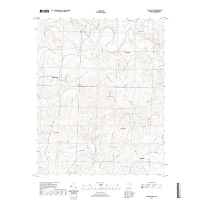
2020 Map of Poughkeepsie
USGS Topo · Published 2020About this map
The Strawberry River winds across the northern landscape of this Sharp County quadrangle, defining a terrain of narrow valleys and ridges in the Ozark foothills. Small agricultural communities and family settlements are connected by a network of rural roads like Hulett Rd and Nelsonville Rd. The map documents three primary village centers: Poughkeepsie in the west, Nelsonville at the central junction, and Calamine in the southeast. Genealogy is well-represented through numerous family-named burial sites, including Spotts Cem, McAdams Cem, and Parsley Cem. Water sources are abundant throughout the township lines of T17N and T16N, with South Big Creek, Mill Cr, and Clayton Cr feeding the regional drainage system. The presence of Brooks Hurricane Hollow in the north suggests the lasting mark of natural events on the local nomenclature and topography.
Find a feature on this map
82 named features on this map. Tap any name to fly to it.
Don’t see what you’re looking for? This feature index may not catch every label — zoom into the map to look around manually.
Map Details
Editions of this 2020 Poughkeepsie Map
This is the sole edition of this map. No revisions or reprints were ever made.
Other maps of this area

1890 · Batesville
USGS Topo · 1:125,000

1891 · Batesville
USGS Topo · 1:125,000

1932 · Strawberry
USGS Topo · 1:62,500

1935 · Strawberry
USGS Topo · 1:62,500

1941 · Strawberry
USGS Topo · 1:62,500

1943 · Cave City
USGS Topo · 1:31,680

1953 · Memphis
USGS Topo · 1:250,000

1955 · Strawberry
USGS Topo · 1:24,000

1956 · Memphis
USGS Topo · 1:250,000

1957 · Poplar Bluff
USGS Topo · 1:250,000