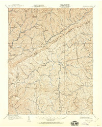
1912 Map of Pound
USGS Topo · Published 1960About this map
Pine Mountain and Black Mountain dominate this Central Appalachian landscape, where the state boundary separates the coal-rich valleys of Kentucky and Virginia. Settled densely along the narrow creek bottoms, towns like Jenkins, McRoberts, and Fleming represent the early 20th-century industrial expansion of the Cumberland Plateau. The Louisville and Nashville RR follows the winding watercourses, providing the critical link for transporting the region's mineral wealth. High mountain passes, including Pound Gap and Payne Gap, served as vital transit points through the steep ridges. The map reveals a high density of rural educational life, noting numerous landmarks such as the Upper Millstone School, Glady Fork School, and Dotson School that served the dispersed families living in hollows like Barkcamp Br and Elkhorn Creek.
Find a feature on this map
141 named features on this map. Tap any name to fly to it.
Don’t see what you’re looking for? This feature index may not catch every label — zoom into the map to look around manually.
Map Details
Editions of this 1912 Pound Map
2 editions found
Other maps of this area

1886 · Grundy
USGS Topo · 1:125,000

1890 · Whitesburg
USGS Topo · 1:125,000

1890 · Grundy
USGS Topo · 1:125,000

1892 · Grundy
USGS Topo · 1:125,000

1892 · Whitesburg
USGS Topo · 1:125,000

1894 · Estillville
USGS Topo · 1:125,000

1897 · Bristol
USGS Topo · 1:125,000

1902 · Bristol
USGS Topo · 1:125,000

1912 · Pound
USGS Topo · 1:48,000

1912 · Hindman
USGS Topo · 1:48,000