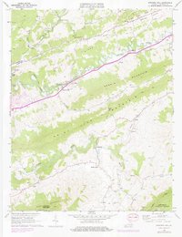
1968 Map of Pounding Mill
USGS Topo · Published 1978About this map
Clinch River and the Norfolk and Western railway corridor dictate the settlement patterns of this Appalachian valley. Small communities and named landmarks like Pounding Mill, Cedar Bluff, and Gillespie are strung along the tracks and water, highlighting a landscape defined by industrial transit and agricultural pockets. The map documents numerous small family and community Cem sites scattered across the ridges of Smith Ridge and Deskin Mountain, providing a vital record for genealogical research in Tazewell County. Further south, the terrain transitions into the more open areas of Ward Cove and the Maiden Spring area, where Maiden Spring Creek flows near the foothills of Paint Lick Mountain. Unique cultural sites such as the Cedar Hills Raceway near Cedar Bluff and the Quarry at Pounding Mill illustrate the varied recreational and extractive uses of the land during the late 1960s.
Find a feature on this map
37 named features on this map. Tap any name to fly to it.
Don’t see what you’re looking for? This feature index may not catch every label — zoom into the map to look around manually.
Map Details
Editions of this 1968 Pounding Mill Map
2 editions found
Other maps of this area

1891 · Tazewell
USGS Topo · 1:125,000

1891 · Abingdon
USGS Topo · 1:125,000

1894 · Abingdon
USGS Topo · 1:125,000

1895 · Tazewell
USGS Topo · 1:125,000

1897 · Tazewell
USGS Topo · 1:125,000

1909 · Abingdon
USGS Topo · 1:96,000

1911 · Abingdon
USGS Topo · 1:125,000

1912 · Pounding Mill
USGS Topo · 1:62,500

1915 · Richlands
USGS Topo · 1:48,000

1916 · Pounding Mill
USGS Topo · 1:62,500