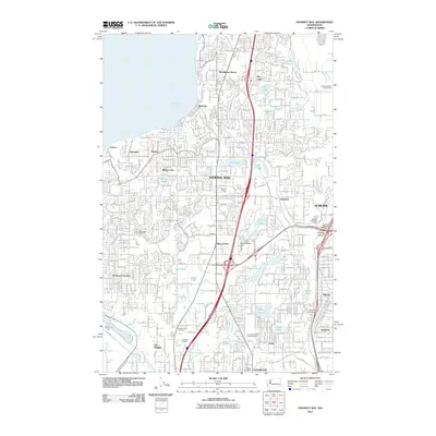
2011 Map of Poverty Bay
USGS Topo · Published 2011About this map
Federal Way dominates the center of this 2011 survey, showing a landscape defined by residential expansion and a complex network of freshwater lakes. Smaller neighborhoods such as Woodmont Beach, Redondo, and Lakota line the shoreline of Poverty Bay, while the inland area is dotted with numerous bodies of water including Mirror Lake, Lake Geneva, and North Lake. The infrastructure of the era is evidenced by the density of Federal Way and its surrounding communities like Seatac Village and Kitts Corner.
Find a feature on this map
53 named features on this map. Tap any name to fly to it.
Don’t see what you’re looking for? This feature index may not catch every label — zoom into the map to look around manually.
Map Details
Editions of this 2011 Poverty Bay Map
This is the sole edition of this map. No revisions or reprints were ever made.
Other maps of this area

1897 · Tacoma
USGS Topo · 1:125,000

1900 · Tacoma
USGS Topo · 1:125,000

1941 · Tacoma South
USGS Topo · 1:62,500

1942 · Lake Tapps
USGS Topo · 1:62,500

1944 · Lake Tapps
USGS Topo · 1:62,500

1944 · Tacoma South
USGS Topo · 1:62,500

1949 · Tacoma North
USGS Topo · 1:24,000

1949 · Poverty Bay
USGS Topo · 1:24,000

1949 · Renton
USGS Topo · 1:24,000
1949 · Des Moines
USGS Topo · 1:24,000