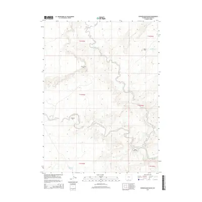
2015 Map of Powder Mountain NE
USGS Topo · Published 2015About this map
Willow Creek Rim overlooks a complex drainage network in this corner of Sweetwater County, where the landscape is defined by the branching waters of E Br Willow Cr and W Br Willow Cr. This high-desert terrain reflects a reliance on managed water sources for land use, evidenced by the Courthouse Butte Reservoir near Church Butte and the Sandy Butte Reservoir to the south. Geologic features such as the Grindstone Wash and Reader Cabin Draw carve through the plateau, while isolated water points like Lower Willow Creek Spring and the seasonal Sand Cr Lake provide vital resources in an otherwise arid environment. The map details the Public Land Survey System grid across multiple townships, illustrating the orderly division of this vast Wyoming rangeland.
Find a feature on this map
17 named features on this map. Tap any name to fly to it.
Don’t see what you’re looking for? This feature index may not catch every label — zoom into the map to look around manually.
Map Details
Editions of this 2015 Powder Mountain NE Map
This is the sole edition of this map. No revisions or reprints were ever made.
Other maps of this area

1954 · Rawlins
USGS Topo · 1:250,000

1954 · Rock Springs
USGS Topo · 1:250,000

1958 · Rawlins
USGS Topo · 1:250,000

1958 · Rock Springs
USGS Topo · 1:250,000

1962 · Rawlins
USGS Topo · 1:250,000

1962 · Rock Springs
USGS Topo · 1:250,000

1967 · Rawlins
USGS Topo · 1:250,000

1970 · South Barrel Spring
USGS Topo · 1:24,000

1970 · Prehistoric Rim
USGS Topo · 1:24,000
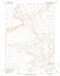
1970 · Powder Mountain NE
USGS Topo · 1:24,000