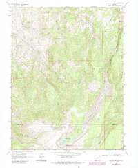
1963 Map of Powderhorn Lakes
USGS Topo · Published 1984About this map
Indian Creek flows through this high-altitude landscape on the border of Gunnison and Hinsdale counties, recorded during the early 1960s with updates from 1978. The area is characterized by significant topographic relief and high-country drainages typical of the Colorado Rockies. A rare sign of human habitation in this wilderness terrain is Grey Ranch, which serves as a notable landmark for those studying land use and ranching history in the region. The map provides a detailed look at the drainage patterns and peaks that define this portion of the Western Slope, capturing the environment before more modern developments or major forest changes.
Find a feature on this map
2 named features on this map. Tap any name to fly to it.
Don’t see what you’re looking for? This feature index may not catch every label — zoom into the map to look around manually.
Map Details
Editions of this 1963 Powderhorn Lakes Map
3 editions found
Other maps of this area

1903 · Lake City
USGS Topo · 1:62,500

1905 · Lake City
USGS Topo · 1:62,500

1908 · Uncompahgre
USGS Topo · 1:125,000

1911 · Uncompahgre
USGS Topo · 1:125,000

1954 · Gateview
USGS Topo · 1:24,000

1956 · Montrose
USGS Topo · 1:250,000

1959 · Montrose
USGS Topo · 1:250,000

1960 · Montrose
USGS Topo · 1:250,000

1962 · Rudolph Hill
USGS Topo · 1:24,000

1962 · Powderhorn
USGS Topo · 1:24,000