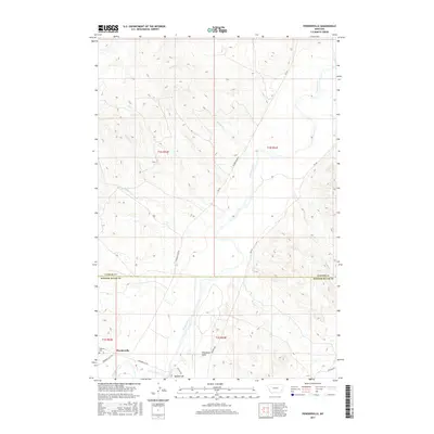
2017 Map of Powderville
USGS Topo · Published 2017About this map
The Powder River meanders through this portion of southeastern Montana, carving a wide valley across the border of Custer and Powder River counties. The small settlement of Powderville sits at a crossroads in the southwestern corner, anchored by the local road network including Powderville Rd and Ekalaka Rd. For genealogists and local historians, the presence of Boothill Cem offers a direct connection to the pioneer era of the region.
Find a feature on this map
28 named features on this map. Tap any name to fly to it.
Don’t see what you’re looking for? This feature index may not catch every label — zoom into the map to look around manually.
Map Details
Editions of this 2017 Powderville Map
This is the sole edition of this map. No revisions or reprints were ever made.
Other maps of this area

1954 · Ekalaka
USGS Topo · 1:250,000

1956 · Ekalaka
USGS Topo · 1:250,000

1958 · Ekalaka
USGS Topo · 1:250,000

1965 · Ekalaka
USGS Topo · 1:250,000

1979 · Blacktail Creek NW
USGS Topo · 1:24,000
1979 · Mills Creek East
USGS Topo · 1:24,000

1979 · Blacktail Creek SW
USGS Topo · 1:24,000

1979 · Powderville
USGS Topo · 1:24,000
1979 · Mills Creek West
USGS Topo · 1:24,000

1979 · Rattlesnake Ridge
USGS Topo · 1:24,000