
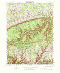
1943 Map of Powell
USGS Topo · Published 1955About this map
Towanda Creek and its tributaries define the landscape of Bradford and Sullivan counties in this mid-century survey. The terrain transitions from the broader valleys near Powell and Franklindale in the north to the heavily timbered uplands of the State Game Lands and Tiadaghton State Forest. A complex network of runs and creeks, including Schrader Creek, deeply carves the southern plateau, where elevations reach peaks like Lamoka Mtn.
Find a feature on this map
103 named features on this map. Tap any name to fly to it.
Don’t see what you’re looking for? This feature index may not catch every label — zoom into the map to look around manually.
Map Details
Editions of this 1943 Powell Map
2 editions found
Other maps of this area

1923 · Towanda
USGS Topo · 1:62,500

1926 · Towanda
USGS Topo · 1:62,500

1927 · Eagles Mere
USGS Topo · 1:48,000

1930 · Warrensville
USGS Topo · 1:62,500

1931 · Troy
USGS Topo · 1:48,000

1932 · Eagle Mere
USGS Topo · 1:62,500

1934 · Warrensville
USGS Topo · 1:62,500

1934 · Laporte
USGS Topo · 1:62,500

1938 · Troy
USGS Topo · 1:62,500

1939 · Sayre
USGS Topo · 1:62,500
Featured Places
- West Burlington Township, PA
- Leroy Township, PA
- Overton Township, PA
- Long Valley, Franklin Township
- Weston, Monroe Township