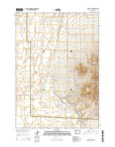
2014 Map of Powell Butte
USGS Topo · Published 2014About this map
Powell Butte stands as the primary landmark in this Central Oregon landscape where the high desert meets organized agricultural and residential development. The map reveals a complex grid of roads often bearing names of regional peaks, such as Sw Mt Bachelor Dr, Sw Mt Hood Dr, and Sw Mt Adams Loop, reflecting the area's visual connection to the Cascade Range. Water management and seasonal drainage define the low-lying areas, notably featuring the course of the Dry River and the presence of Shumway Lake.
Find a feature on this map
64 named features on this map. Tap any name to fly to it.
Don’t see what you’re looking for? This feature index may not catch every label — zoom into the map to look around manually.
Map Details
Editions of this 2014 Powell Butte Map
This is the sole edition of this map. No revisions or reprints were ever made.
Other maps of this area

1926 · Bend
USGS Topo · 1:125,000

1929 · Bend
USGS Topo · 1:125,000

1955 · Bend
USGS Topo · 1:250,000

1957 · Bend
USGS Topo · 1:250,000

1958 · Bend
USGS Topo · 1:250,000

1961 · Redmond
USGS Topo · 1:24,000

1962 · Forked Horn Butte
USGS Topo · 1:24,000

1962 · Oneil
USGS Topo · 1:24,000
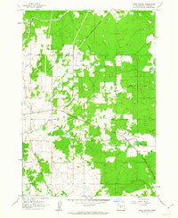
1962 · Bend Airport
USGS Topo · 1:24,000

1962 · Huston Lake
USGS Topo · 1:24,000