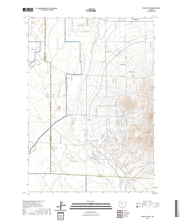
2023 Map of Powell Butte
USGS Topo · Published 2023About this map
The Powell Buttes dominate the southeastern landscape of this Central Oregon region, rising sharply above the high desert floor. This 2023 survey by the U.S. Geological Survey details the interface between the agricultural and residential growth near Powell Butte and the restricted grounds of the NG Biak Training Center Coutes. The drainage of the ephemeral Dry River cuts through the center of the quadrangle, passing near Shumway Lake and a grid of rural roads named for regional peaks and local families, such as SW Mt Hood Dr and SW McCafferty Rd. The map illustrates the contemporary settlement pattern of Crook County and Deschutes County, where land use transitions from military training zones to residential enclaves along SW Rust Bucket Rd and Aquatic View Ln.
Find a feature on this map
63 named features on this map. Tap any name to fly to it.
Don’t see what you’re looking for? This feature index may not catch every label — zoom into the map to look around manually.
Map Details
Editions of this 2023 Powell Butte Map
This is the sole edition of this map. No revisions or reprints were ever made.
Other maps of this area

1926 · Bend
USGS Topo · 1:125,000

1929 · Bend
USGS Topo · 1:125,000

1955 · Bend
USGS Topo · 1:250,000

1957 · Bend
USGS Topo · 1:250,000

1958 · Bend
USGS Topo · 1:250,000

1961 · Redmond
USGS Topo · 1:24,000

1962 · Forked Horn Butte
USGS Topo · 1:24,000

1962 · Oneil
USGS Topo · 1:24,000
1962 · Bend Airport
USGS Topo · 1:24,000

1962 · Huston Lake
USGS Topo · 1:24,000