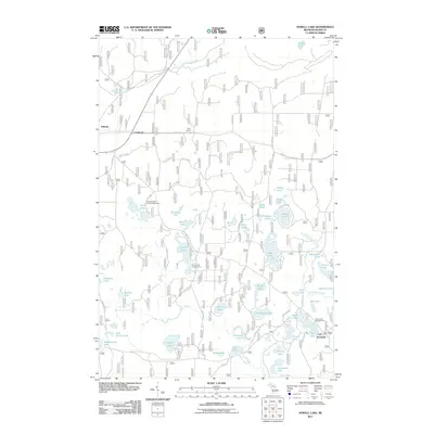
2011 Map of Powell Lake
USGS Topo · Published 2011About this map
Coalwood and Stillman sit along the western edge of this landscape, marking small settlement points in a territory defined by an intricate network of forest roads and glacial lakes. The dense concentration of water bodies, including Powell Lake, Hovey Lake, and Peck Lake, illustrates the post-glacial geography of Alger County. These lakes are interconnected by a system of Forest Service roads and county highways such as Co HWY 540 and Powell Lake Rd, supporting a seasonal economy centered on the Hovey Lake Campground and Island Lake Campground.
Find a feature on this map
57 named features on this map. Tap any name to fly to it.
Don’t see what you’re looking for? This feature index may not catch every label — zoom into the map to look around manually.
Map Details
Editions of this 2011 Powell Lake Map
This is the sole edition of this map. No revisions or reprints were ever made.
Other maps of this area

1931 · Skeels Lake NE
USGS Topo · 1:31,680

1931 · Munising SE
USGS Topo · 1:31,680

1958 · Corner Lake
USGS Topo · 1:62,500

1958 · Trenary
USGS Topo · 1:62,500

1958 · Munising
USGS Topo · 1:62,500

1958 · Au Train
USGS Topo · 1:62,500

1958 · Marquette
USGS Topo · 1:250,000

1960 · Marquette
USGS Topo · 1:250,000

1961 · Marquette
USGS Topo · 1:250,000

1968 · Marquette
USGS Topo · 1:250,000