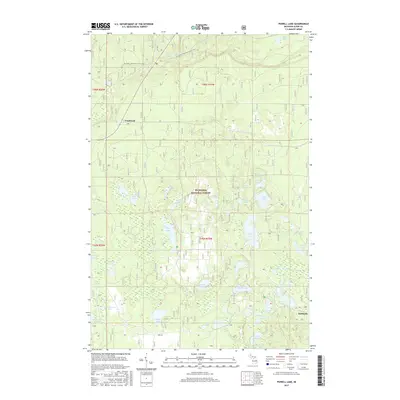
2017 Map of Powell Lake
USGS Topo · Published 2017About this map
The Hiawatha National Forest dominates this section of Alger County, where a dense network of glacial lakes and small streams defines the landscape. The N Country National Scenic Trail traverses the northern portion of the quadrangle, passing near Valley Spur Cr and the heights above the Indian River drainage. Named settlements are sparse, with Coalwood situated near the western edge and Kentucky located further south, reflecting the historical timber and rail-influenced development of this inland wilderness.
Find a feature on this map
45 named features on this map. Tap any name to fly to it.
Don’t see what you’re looking for? This feature index may not catch every label — zoom into the map to look around manually.
Map Details
Editions of this 2017 Powell Lake Map
This is the sole edition of this map. No revisions or reprints were ever made.
Other maps of this area

1931 · Skeels Lake NE
USGS Topo · 1:31,680

1931 · Munising SE
USGS Topo · 1:31,680

1958 · Corner Lake
USGS Topo · 1:62,500

1958 · Trenary
USGS Topo · 1:62,500

1958 · Munising
USGS Topo · 1:62,500

1958 · Au Train
USGS Topo · 1:62,500

1958 · Marquette
USGS Topo · 1:250,000

1960 · Marquette
USGS Topo · 1:250,000

1961 · Marquette
USGS Topo · 1:250,000

1968 · Marquette
USGS Topo · 1:250,000