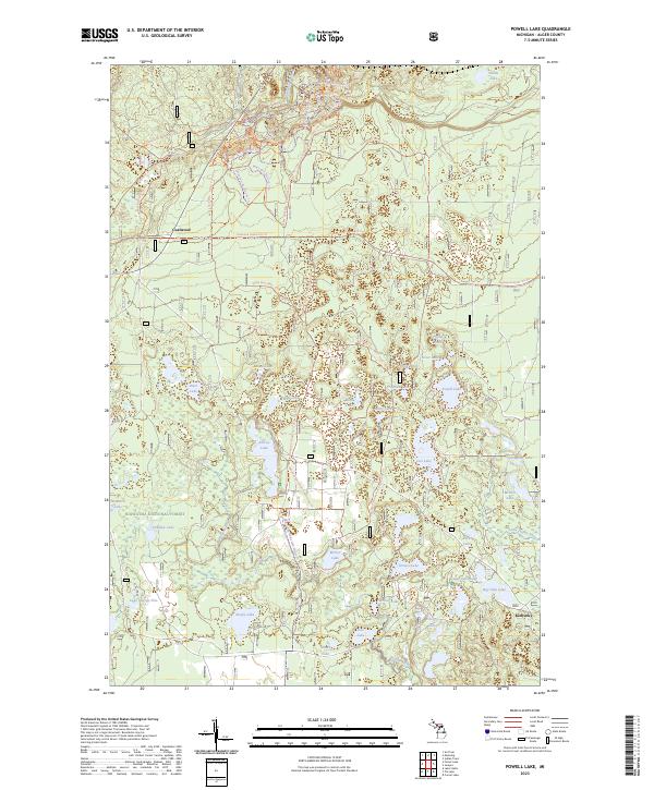
2023 Map of Powell Lake
USGS Topo · Published 2023About this map
Hiawatha National Forest dominates this landscape in Alger County, defined by a dense concentration of glacial lakes and an extensive network of modern recreational trails. The settlement of Coalwood sits in the northwest, serving as a focal point for several branching paths including the Coalwood Grade Atv Trl. The map illustrates a complex hydrological system where larger bodies like Powell Lake and Hovey Lake are interspersed with smaller ponds such as Misty Lake and Moth Lake. The southern portion of the quadrangle is bisected by the Indian Wild And Scenic River, which flows through a mosaic of wetlands. This recent survey highlights the area's contemporary role as a recreational hub, detailing specialized routes like the Oakwood Equestrian North Loop Trl and the North Country National Scenic Trl, while identifying small localities like Kentucky in the southeast.
Find a feature on this map
58 named features on this map. Tap any name to fly to it.
Don’t see what you’re looking for? This feature index may not catch every label — zoom into the map to look around manually.
Map Details
Editions of this 2023 Powell Lake Map
This is the sole edition of this map. No revisions or reprints were ever made.
Other maps of this area

1931 · Skeels Lake NE
USGS Topo · 1:31,680

1931 · Munising SE
USGS Topo · 1:31,680

1958 · Corner Lake
USGS Topo · 1:62,500

1958 · Trenary
USGS Topo · 1:62,500

1958 · Munising
USGS Topo · 1:62,500

1958 · Au Train
USGS Topo · 1:62,500

1958 · Marquette
USGS Topo · 1:250,000

1960 · Marquette
USGS Topo · 1:250,000

1961 · Marquette
USGS Topo · 1:250,000

1968 · Marquette
USGS Topo · 1:250,000