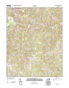
2013 Map of Powellton
USGS Topo · Published 2013About this map
The Meherrin River anchors this landscape in Brunswick County, winding past several historically significant sites including Fort Christanna and the nearby Fort Hill. This 2013 survey illustrates the rural character of the region south of Lawrenceville, where small clusters of homes and family-named roads define the settlement pattern. Places like Powellton, Fitzhugh, and Old Fitzhugh are situated along a network of routes such as Western Mill Rd and Dry Bread Rd. The map also captures numerous tributaries like Starks Mill Br and Brandy Cr, suggesting the agricultural and mill history of the local drainage basins. Crossings like Gholson Bridge and Westward Bridge provide critical links across the river, connecting isolated communities like Greentown and Wyche to the larger county seat area.
Find a feature on this map
87 named features on this map. Tap any name to fly to it.
Don’t see what you’re looking for? This feature index may not catch every label — zoom into the map to look around manually.
Map Details
Editions of this 2013 Powellton Map
This is the sole edition of this map. No revisions or reprints were ever made.
Other maps of this area

1918 · Lawrenceville
USGS Topo · 1:62,500

1919 · Mc Kenney
USGS Topo · 1:48,000

1919 · White Plains
USGS Topo · 1:48,000

1919 · Emporia
USGS Topo · 1:62,500

1920 · Lawrenceville
USGS Topo · 1:48,000

1920 · White Plains
USGS Topo · 1:62,500

1921 · Mc Kenney
USGS Topo · 1:62,500

1921 · Lawrenceville
USGS Topo · 1:62,500

1942 · Lawrenceville
USGS Topo · 1:62,500

1942 · Emporia
USGS Topo · 1:62,500