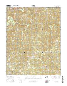
2016 Map of Powellton
USGS Topo · Published 2016About this map
Ft Hill Fort Christanna stands as a prominent historical landmark overlooking the Meherrin River, anchoring a landscape defined by its network of rural settlements and family burial grounds in Brunswick County. This 2016 survey documents the enduring spatial layout of communities such as Lawrenceville, Brunswick, and Powellton. The river is spanned by notable structures including the Gholson Bridge and Westward Bridge, while the surrounding terrain is etched with numerous family and community cemeteries. Genealogists will find particular value in the distribution of sites like Hardy Cem, Lynch Cem, and Vaughan Cem. The transition from the town center of Lawrenceville Hills to the outlying crossings of Coldwater Cr and Great Cr reflects a classic Virginia Piedmont pattern of scattered farmsteads and small crossroad hamlets connected by narrow county roads.
Find a feature on this map
90 named features on this map. Tap any name to fly to it.
Don’t see what you’re looking for? This feature index may not catch every label — zoom into the map to look around manually.
Map Details
Editions of this 2016 Powellton Map
This is the sole edition of this map. No revisions or reprints were ever made.
Other maps of this area

1918 · Lawrenceville
USGS Topo · 1:62,500

1919 · Mc Kenney
USGS Topo · 1:48,000

1919 · White Plains
USGS Topo · 1:48,000

1919 · Emporia
USGS Topo · 1:62,500

1920 · Lawrenceville
USGS Topo · 1:48,000

1920 · White Plains
USGS Topo · 1:62,500

1921 · Mc Kenney
USGS Topo · 1:62,500

1921 · Lawrenceville
USGS Topo · 1:62,500

1942 · Lawrenceville
USGS Topo · 1:62,500

1942 · Emporia
USGS Topo · 1:62,500