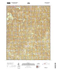
2019 Map of Powellton
USGS Topo · Published 2019About this map
Fort Christanna and the adjacent Ft Hill occupy a prominent bend in the Meherrin River, marking a site of significant early colonial and Native American history in Brunswick County. This landscape is defined by the winding river and its numerous tributaries, including Little Coldwater Cr and Brandy Cr, which carve through the terrain south of Lawrenceville. The map reveals a deeply rooted rural community evidenced by an extensive network of family and community burial grounds, such as Lynch Cem, Rawlings Cem, and Vaughan Cem. Small settlements like Greentown, Powellton, and Fitzhugh are connected by a web of local routes including Dry Bread Rd and Western Mill Rd. The crossing at Gholson Bridge serves as a primary link across the Meherrin, anchoring the transit patterns of this southern Virginia region.
Find a feature on this map
90 named features on this map. Tap any name to fly to it.
Don’t see what you’re looking for? This feature index may not catch every label — zoom into the map to look around manually.
Map Details
Editions of this 2019 Powellton Map
This is the sole edition of this map. No revisions or reprints were ever made.
Other maps of this area

1918 · Lawrenceville
USGS Topo · 1:62,500

1919 · Mc Kenney
USGS Topo · 1:48,000

1919 · White Plains
USGS Topo · 1:48,000

1919 · Emporia
USGS Topo · 1:62,500

1920 · Lawrenceville
USGS Topo · 1:48,000

1920 · White Plains
USGS Topo · 1:62,500

1921 · Mc Kenney
USGS Topo · 1:62,500

1921 · Lawrenceville
USGS Topo · 1:62,500

1942 · Lawrenceville
USGS Topo · 1:62,500

1942 · Emporia
USGS Topo · 1:62,500