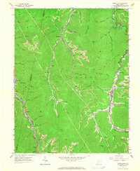
1965 Map of Powellton
USGS Topo · Published 1966About this map
Armstrong Creek and Cabin Creek carve through the steep topography of the Kanawha and Fayette county border, defining a landscape dominated by the coal and rail industries of the mid-1960s. The settlement of Powellton sits centrally along the creek, flanked by numerous mines and strip mines that follow the winding contours of the hillsides. Heavy infrastructure is evident throughout the narrow valleys, from the tipple at Mahan to the substation near McDunn.
Find a feature on this map
69 named features on this map. Tap any name to fly to it.
Don’t see what you’re looking for? This feature index may not catch every label — zoom into the map to look around manually.
Map Details
Editions of this 1965 Powellton Map
2 editions found
Other maps of this area

1891 · Raleigh
USGS Topo · 1:125,000

1897 · Kanawha Falls
USGS Topo · 1:125,000

1897 · Raleigh
USGS Topo · 1:125,000

1900 · Kanawha Falls
USGS Topo · 1:125,000

1901 · Kanawha Falls
USGS Topo · 1:125,000

1902 · Raleigh
USGS Topo · 1:125,000

1908 · Fayetteville
USGS Topo · 1:48,000

1908 · Montgomery
USGS Topo · 1:48,000

1910 · Fayetteville
USGS Topo · 1:62,500

1910 · Montgomery
USGS Topo · 1:62,500