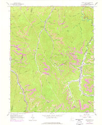
1965 Map of Powellton
USGS Topo · Published 1977About this map
Armstrong Mountain and the deep valleys of Armstrong Creek define this coal-producing landscape on the Kanawha and Fayette County line. The map captures a high-intensity extraction economy, where numerous Strip Mines and conveyor systems serve the industrial towns of Powellton, Elkridge, and Burnwell. These settlements are linked by a dense network of rail lines, including the Chesapeake and Ohio and Norfolk and Western railroads, which navigate the narrow hollows. Deeply personal history is preserved in small family burial grounds like the Craig Cemeteries and Johnson Cem, while larger community landmarks such as Meadow Haven Memorial Park appear near Hamilton. The terrain is marked by dozens of branch streams like Sycamore Branch and Robinson Branch, illustrating the complex drainage patterns that dictated the placement of early mining camps and tipples.
Find a feature on this map
69 named features on this map. Tap any name to fly to it.
Don’t see what you’re looking for? This feature index may not catch every label — zoom into the map to look around manually.
Map Details
Editions of this 1965 Powellton Map
2 editions found
Other maps of this area

1891 · Raleigh
USGS Topo · 1:125,000

1897 · Kanawha Falls
USGS Topo · 1:125,000

1897 · Raleigh
USGS Topo · 1:125,000

1900 · Kanawha Falls
USGS Topo · 1:125,000

1901 · Kanawha Falls
USGS Topo · 1:125,000

1902 · Raleigh
USGS Topo · 1:125,000

1908 · Fayetteville
USGS Topo · 1:48,000

1908 · Montgomery
USGS Topo · 1:48,000

1910 · Fayetteville
USGS Topo · 1:62,500

1910 · Montgomery
USGS Topo · 1:62,500