2011 Map of Power
USGS Topo · Published 2011About this map
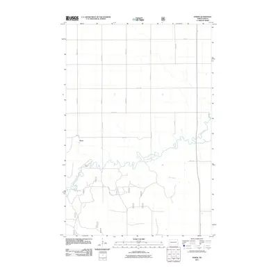
The Sheyenne River meanders sharply through this rural landscape in the eastern North Dakota plains, creating a complex series of oxbows and bends that dominate the local topography. At the heart of this riverine system lies the Mirror Pool, a distinct water feature situated just south of the main river channel. The small settlement of Power serves as a central reference point in an area otherwise defined by a systematic grid of agricultural section lines and rural thoroughfares such as County Rd 2 and County Rd 23. Near a prominent bend in the river, the Four H Camp provides a focal point for community and recreational activity, while the surrounding terrain remains predominantly dedicated to the large-scale agriculture typical of the Red River Valley periphery during the early 21st century.
Find a feature on this map
15 named features on this map. Tap any name to fly to it.
Don’t see what you’re looking for? This feature index may not catch every label — zoom into the map to look around manually.
Map Details
Editions of this 2011 Power Map
This is the sole edition of this map. No revisions or reprints were ever made.
Other maps of this area

1895 · Casselton
USGS Topo · 1:125,000

1897 · Casselton
USGS Topo · 1:125,000

1907 · Wyndmere
USGS Topo · 1:125,000

1953 · Fargo
USGS Topo · 1:250,000

1956 · Fargo
USGS Topo · 1:250,000

1959 · Kindred
USGS Topo · 1:24,000

1959 · Leonard
USGS Topo · 1:24,000

1959 · Wyndmere NE
USGS Topo · 1:24,000

1960 · Power
USGS Topo · 1:24,000

1960 · Barrie
USGS Topo · 1:24,000