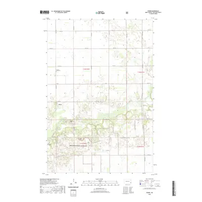
2020 Map of Power
USGS Topo · Published 2020About this map
Sheyenne National Grassland dominates the southern half of this Richland County landscape, where the Sheyenne River meanders through a complex of wetlands and forested bottomlands. The settlement of Power sits just north of the public lands, serving as a focal point for the surrounding agricultural sections. The map reveals important genealogical landmarks such as the Helendale Lutheran Cem and Zion Lutheran Cem, which anchor the local community's history near the prairie-forest transition. Outdoor heritage is marked by the winding path of the N Country National Scenic Trail, which traverses the grassland near Mirror Pool. This topographic study captures a region where managed federal prairie meets the traditional township grid, preserving the location of established rural congregations and historical property boundaries in Barrie Township.
Find a feature on this map
22 named features on this map. Tap any name to fly to it.
Don’t see what you’re looking for? This feature index may not catch every label — zoom into the map to look around manually.
Map Details
Editions of this 2020 Power Map
This is the sole edition of this map. No revisions or reprints were ever made.
Other maps of this area

1895 · Casselton
USGS Topo · 1:125,000

1897 · Casselton
USGS Topo · 1:125,000

1907 · Wyndmere
USGS Topo · 1:125,000

1953 · Fargo
USGS Topo · 1:250,000

1956 · Fargo
USGS Topo · 1:250,000

1959 · Kindred
USGS Topo · 1:24,000

1959 · Leonard
USGS Topo · 1:24,000

1959 · Wyndmere NE
USGS Topo · 1:24,000

1960 · Power
USGS Topo · 1:24,000

1960 · Barrie
USGS Topo · 1:24,000