1998 Map of Power
USGS Topo · Published 2000About this map
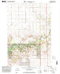
The Sheyenne River winds through the southeastern North Dakota prairie in this survey, carving a distinct corridor of wooded bottomlands and oxbows like Mirror Pool. This landscape is characterized by the expansive protected acreage of the Sheyenne National Grassland, which dominates the southern half of the map. Settlement patterns are tied to the township structure, with community life anchored by the Town Hall and rural congregations at Helendale Ch, Zion Ch, and Barrie Ch. The small hamlet of Power and several scattered farmsteads are connected by a grid of section-line roads, illustrating the agricultural layout of Helendale and Barrie townships. A local Cem near the Helendale church provides a focal point for genealogical research in this sparsely populated region.
Find a feature on this map
12 named features on this map. Tap any name to fly to it.
Don’t see what you’re looking for? This feature index may not catch every label — zoom into the map to look around manually.
Map Details
Editions of this 1998 Power Map
This is the sole edition of this map. No revisions or reprints were ever made.
Other maps of this area

1895 · Casselton
USGS Topo · 1:125,000

1897 · Casselton
USGS Topo · 1:125,000

1907 · Wyndmere
USGS Topo · 1:125,000

1953 · Fargo
USGS Topo · 1:250,000

1956 · Fargo
USGS Topo · 1:250,000

1959 · Kindred
USGS Topo · 1:24,000

1959 · Leonard
USGS Topo · 1:24,000

1959 · Wyndmere NE
USGS Topo · 1:24,000

1960 · Power
USGS Topo · 1:24,000

1960 · Barrie
USGS Topo · 1:24,000