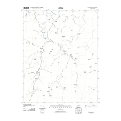
2010 Map of Powersburg
USGS Topo · Published 2010About this map
Otter Creek meanders through the heart of this Wayne County landscape, carving a path through a series of hollows and ridges that define the local topography. Small rural communities like Slickford, Jimtown, and Hidalgo are connected by a network of winding roads, including Cooper Slickford Rd and Jimtown Rd. These settlements are often centered near water sources or along the base of prominent features such as Taylor Mountain and Hog Mountain.
Find a feature on this map
74 named features on this map. Tap any name to fly to it.
Don’t see what you’re looking for? This feature index may not catch every label — zoom into the map to look around manually.
Map Details
Editions of this 2010 Powersburg Map
This is the sole edition of this map. No revisions or reprints were ever made.
Other maps of this area

1911 · Monticello
USGS Topo · 1:62,500

1914 · Monticello
USGS Topo · 1:62,500

1929 · Byrdstown
USGS Topo · 1:62,500

1934 · Pall Mall
USGS Topo · 1:62,500

1953 · Parnell
USGS Topo · 1:24,000

1953 · Monticello
USGS Topo · 1:24,000

1954 · Parmleysville
USGS Topo · 1:24,000

1954 · Cumberland City
USGS Topo · 1:24,000

1954 · Savage
USGS Topo · 1:24,000

1954 · Powersburg
USGS Topo · 1:24,000