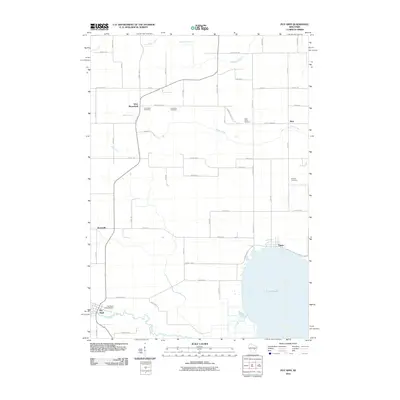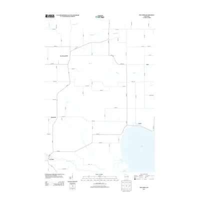
2022 Map of Poy Sippi
USGS Topo · Published 2022About this map
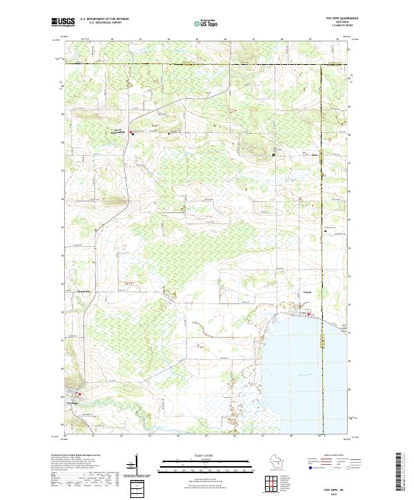
Poy Sippi and its surrounding wetlands occupy a landscape defined by the drainage of the Pine River into the northwestern reaches of Lake Poygan. This area of Waushara County is characterized by scattered rural settlements like West Bloomfield, Metz, and Tustin, the latter situated directly on the lake's northern shore. The map reveals a high concentration of community landmarks that are vital for local history, particularly its many burial grounds including the Old German Lutheran Cem, Concordia Cem, and East Bloomfield Cem. The network of county highways and local roads, such as Co HWY H and Akron Ave, connects these small farming and lakeside hamlets. To the north, the terrain transitions into the valleys of Mosquito Cr and Hatton Cr, while the eastern portion highlights the marshy shoreline at Old Indian Point.
Find a feature on this map
55 named features on this map. Tap any name to fly to it.
Don’t see what you’re looking for? This feature index may not catch every label — zoom into the map to look around manually.
Map Details
Editions of this 2022 Poy Sippi Map
This is the sole edition of this map. No revisions or reprints were ever made.
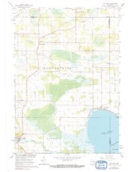
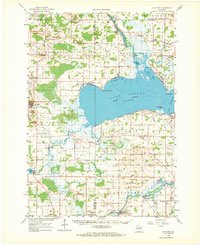
Historical Maps of Fremont Through Time
7 maps found