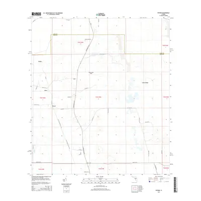
2015 Map of Poyner
USGS Topo · Published 2015About this map
Eva and Poyner anchor this central Florida landscape at the boundary of Lake and Polk Counties. The area is characterized by a network of rural roads and distinct topographic rises like Rattlesnake Ridge, which stand out against the wetlands and watercourses such as Pony Cr. Transportation and recreation define the local geography, with SR-33 and Commonwealth Ave N providing primary transit while the Florida National Scenic Trail winds through the southwestern quadrant. Smaller named settlements like Withla, Berry, and Citrus Ridge indicate a dispersed community structure. Large tracts of land are organized by township and range lines, intersected by curiously named local routes such as Hog Farm Rd and Crash Creek Rd, reflecting a landscape dedicated to agriculture and rural living.
Find a feature on this map
42 named features on this map. Tap any name to fly to it.
Don’t see what you’re looking for? This feature index may not catch every label — zoom into the map to look around manually.
Map Details
Editions of this 2015 Poyner Map
This is the sole edition of this map. No revisions or reprints were ever made.
Other maps of this area

1944 · Providence
USGS Topo · 1:31,680

1944 · Polk City
USGS Topo · 1:31,680

1955 · Orlando
USGS Topo · 1:250,000

1957 · Orlando
USGS Topo · 1:250,000

1958 · Orlando
USGS Topo · 1:250,000

1959 · Gum Lake
USGS Topo · 1:24,000

1959 · Lake Nellie
USGS Topo · 1:24,000

1959 · Lake Louisa
USGS Topo · 1:24,000

1959 · Lake Louisa SW
USGS Topo · 1:24,000

1959 · Poyner
USGS Topo · 1:24,000