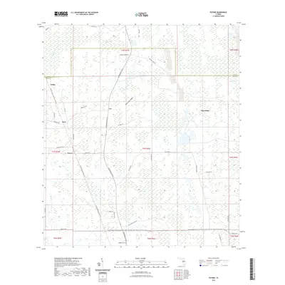
2021 Map of Poyner
USGS Topo · Published 2021About this map
The Green Swamp and its associated wetlands dominate this portion of the Florida interior, where the Withlacoochee River begins its course and Loggy Pond Swamp stretches across the northern boundary. Small settlements like Eva, Poyner, and Berry are connected by a network of ranch and service roads, including the descriptive Shoe String Ranch Rd and Hog Farm Rd. The landscape is defined by its transition from low-lying hydrology to slight elevations like Rattlesnake Ridge and Citrus Ridge. Long-distance recreational corridors are prominent, with the General James A Van Fleet State Trail and the Florida National Scenic Trail cutting through the terrain. This survey reflects a sparsely populated rural district where the natural environment of Turkey Creek and various ponds dictates the layout of local infrastructure and private landholdings.
Find a feature on this map
50 named features on this map. Tap any name to fly to it.
Don’t see what you’re looking for? This feature index may not catch every label — zoom into the map to look around manually.
Map Details
Editions of this 2021 Poyner Map
This is the sole edition of this map. No revisions or reprints were ever made.
Other maps of this area

1944 · Providence
USGS Topo · 1:31,680

1944 · Polk City
USGS Topo · 1:31,680

1955 · Orlando
USGS Topo · 1:250,000

1957 · Orlando
USGS Topo · 1:250,000

1958 · Orlando
USGS Topo · 1:250,000

1959 · Gum Lake
USGS Topo · 1:24,000

1959 · Lake Nellie
USGS Topo · 1:24,000

1959 · Lake Louisa
USGS Topo · 1:24,000

1959 · Lake Louisa SW
USGS Topo · 1:24,000

1959 · Poyner
USGS Topo · 1:24,000