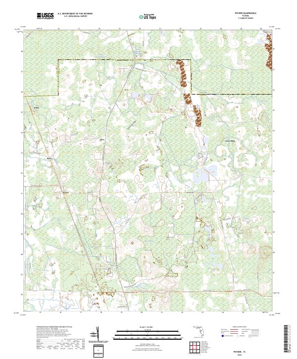
2024 Map of Poyner
USGS Topo · Published 2024About this map
The Green Swamp dominates this Central Florida landscape, defining the rural character of the border between Lake and Polk counties. Small, historically scattered settlements like Eva, Poyner, and Berry are connected by a network of ranch roads and specialized trails. The geography is characterized by hydrologic features such as Loggy Pond Swamp and Turkey Creek, which weave through the low-lying terrain alongside Rattlesnake Ridge. Modern recreation and conservation efforts are evident in the crossing of the Florida National Scenic Trail and the General James A Van Fleet State Trail, which follow corridor paths through the wetlands. The presence of Citrus Ridge and various ranch-named thoroughfares like Bronson Ranch Road and Shoe String Ranch Road reflects the area's long-standing agricultural and pastoral heritage.
Find a feature on this map
49 named features on this map. Tap any name to fly to it.
Don’t see what you’re looking for? This feature index may not catch every label — zoom into the map to look around manually.
Map Details
Editions of this 2024 Poyner Map
This is the sole edition of this map. No revisions or reprints were ever made.
Other maps of this area

1944 · Providence
USGS Topo · 1:31,680

1944 · Polk City
USGS Topo · 1:31,680

1955 · Orlando
USGS Topo · 1:250,000

1957 · Orlando
USGS Topo · 1:250,000

1958 · Orlando
USGS Topo · 1:250,000

1959 · Gum Lake
USGS Topo · 1:24,000

1959 · Lake Nellie
USGS Topo · 1:24,000

1959 · Lake Louisa
USGS Topo · 1:24,000

1959 · Lake Louisa SW
USGS Topo · 1:24,000

1959 · Poyner
USGS Topo · 1:24,000