1922 Map of Pozo
USGS Topo · Published 1931About this map
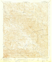
Pozo sits at the heart of this early twentieth-century survey, surrounded by a complex network of waterways that define the Central Coast interior. The landscape is characterized by the headwaters of the Salinas River and its numerous tributaries, including Pozo Creek, Toro Creek, and Alamo Creek. This era of development is marked by a distributed network of rural schoolhouses, such as Huerhuero School, Highland School, and El Dorado School, which served the scattered homesteads and ranching families of the Santa Lucia Range.
Find a feature on this map
28 named features on this map. Tap any name to fly to it.
Don’t see what you’re looking for? This feature index may not catch every label — zoom into the map to look around manually.
Map Details
Editions of this 1922 Pozo Map
3 editions found

Other maps of this area

1897 · San Luis Obispo
USGS Topo · 1:62,500

1897 · Arroyo Grande
USGS Topo · 1:62,500

1900 · San Luis
USGS Topo · 1:125,000

1914 · Cholame
USGS Topo · 1:125,000

1915 · Cholame
USGS Topo · 1:125,000

1917 · Cholame
USGS Topo · 1:125,000

1919 · Paso Robles
USGS Topo · 1:62,500

1922 · Pozo
USGS Topo · 1:62,500

1922 · Nipomo
USGS Topo · 1:62,500

1932 · La Panza
USGS Topo · 1:48,000