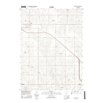
2015 Map of Prairie City
USGS Topo · Published 2015About this map
Prairie City anchors the northwestern corner of this 2015 survey, where the town's residential grid meets the expansive agricultural landscape of Jasper County. The map reveals a high density of rural burial grounds, such as Waveland Cem, Westview Cem, and Mound Prairie Cem, which serve as vital landmarks for genealogists tracing early families. The terrain is defined by a network of drainage systems, including the southward flows of Squaw Cr, Calhoun Cr, and Prairie Cr. Along the southern boundary, the map captures the transition into Marion County, marked by Ritter Worth Cem near the fork of Eaton Valley Cr. The systematic organization of county roads and section lines illustrates the enduring grid of the Public Land Survey System, providing a clear reference for locating historical property boundaries and family farmsteads in the Des Moines Township area.
Find a feature on this map
57 named features on this map. Tap any name to fly to it.
Don’t see what you’re looking for? This feature index may not catch every label — zoom into the map to look around manually.
Map Details
Editions of this 2015 Prairie City Map
This is the sole edition of this map. No revisions or reprints were ever made.
Other maps of this area

1909 · Knoxville
USGS Topo · 1:62,500

1910 · Milo
USGS Topo · 1:62,500

1912 · Knoxville
USGS Topo · 1:62,500

1930 · Mitchellville
USGS Topo · 1:62,500

1954 · Des Moines
USGS Topo · 1:250,000

1956 · Des Moines
USGS Topo · 1:250,000

1957 · Des Moines
USGS Topo · 1:250,000

1965 · Pleasantville
USGS Topo · 1:24,000

1965 · Prairie City
USGS Topo · 1:24,000

1965 · Newton
USGS Topo · 1:24,000
Featured Places
- Prairie City, IA
- Red Rock Township, IA
- Mound Prairie Township, IA
- Washington Township, IA
- Fairview Township, IA