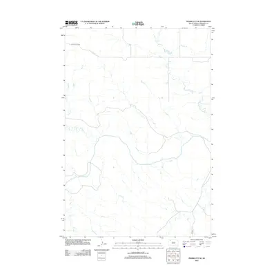
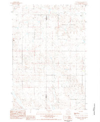
2012 Map of Prairie City NE
USGS Topo · Published 2012About this map
The S Fork Grand River meanders across this rural landscape in Perkins County, forming the primary drainage for a series of tributary creeks. The terrain is defined by the hydrologic network of Duck Creek in the north and the uniquely named Big Nasty Creek and Gooseneck Creek to the west. This 2012 survey documents a sparsely settled region of South Dakota where movement is dictated by a few key thoroughfares like Holland Center Road and Divide Road. The lack of dense town centers highlights the agricultural and ranching character of the land, providing a clear record of modern property access and water resources in the High Plains.
Find a feature on this map
6 named features on this map. Tap any name to fly to it.
Don’t see what you’re looking for? This feature index may not catch every label — zoom into the map to look around manually.
Map Details
Editions of this 2012 Prairie City NE Map
This is the sole edition of this map. No revisions or reprints were ever made.
Other maps of this area

1954 · Lemmon
USGS Topo · 1:250,000

1957 · Lemmon
USGS Topo · 1:250,000

1983 · Grandmas Butte
USGS Topo · 1:24,000

1983 · Cow Butte SE
USGS Topo · 1:24,000

1983 · Prairie City NE
USGS Topo · 1:24,000
1983 · Prairie City NW
USGS Topo · 1:24,000

1983 · Little Nasty Creek
USGS Topo · 1:24,000
1983 · White Hill
USGS Topo · 1:24,000
1983 · Prairie City
USGS Topo · 1:24,000
1983 · Cow Butte SW
USGS Topo · 1:24,000