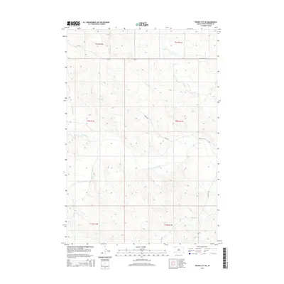
2015 Map of Prairie City NE
USGS Topo · Published 2015About this map
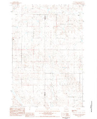
The South Fork Grand River meanders across this Perkins County landscape, carving a wide valley through the high plains of South Dakota. The drainage pattern is defined by several creatively named tributaries, including the eastward-flowing Big Nasty Cr and Gooseneck Cr. To the north, Duck Cr winds through the rolling terrain, illustrating the hydrologic network that sustains this ranching and agricultural region. The human imprint on the land follows a strict section-line grid, typical of the Public Land Survey System, with roads such as 115th St and Holland Center Rd tracing the township boundaries of t21n r11e and t20n r11e. Long-distance transit is represented by Sidney Rd and Divide Rd, which cut diagonally across the topography, likely following older tracks or natural ridges between the creek drainages.
Find a feature on this map
16 named features on this map. Tap any name to fly to it.
Don’t see what you’re looking for? This feature index may not catch every label — zoom into the map to look around manually.
Map Details
Editions of this 2015 Prairie City NE Map
This is the sole edition of this map. No revisions or reprints were ever made.
Other maps of this area

1954 · Lemmon
USGS Topo · 1:250,000

1957 · Lemmon
USGS Topo · 1:250,000

1983 · Grandmas Butte
USGS Topo · 1:24,000

1983 · Cow Butte SE
USGS Topo · 1:24,000

1983 · Prairie City NE
USGS Topo · 1:24,000
1983 · Prairie City NW
USGS Topo · 1:24,000

1983 · Little Nasty Creek
USGS Topo · 1:24,000
1983 · White Hill
USGS Topo · 1:24,000
1983 · Prairie City
USGS Topo · 1:24,000
1983 · Cow Butte SW
USGS Topo · 1:24,000