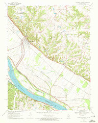
1970 Map of Prairie Du Rocher
USGS Topo · Published 1972About this map
The Mississippi River floodplain dominates this 1970 landscape, where the Illinois and Missouri border follows the winding river channel near Jackson Island and Schmidts Island. Beneath the steep bluffs of the American Bottoms lies the Modoc Rock Shelter National Historic Site, a significant archaeological landmark. The settlement of Prairie du Rocher sits at the base of these bluffs, serving as a hub for the surrounding agricultural bottomlands and nearby quarries.
Find a feature on this map
36 named features on this map. Tap any name to fly to it.
Don’t see what you’re looking for? This feature index may not catch every label — zoom into the map to look around manually.
Map Details
Editions of this 1970 Prairie Du Rocher Map
3 editions found
Other maps of this area

1907 · Weingarten
USGS Topo · 1:62,500

1909 · Weingarten
USGS Topo · 1:62,500

1912 · Baldwin
USGS Topo · 1:62,500

1914 · Baldwin
USGS Topo · 1:62,500

1915 · Renault
USGS Topo · 1:62,500

1915 · Chester
USGS Topo · 1:62,500

1940 · Renault
USGS Topo · 1:62,500

1942 · Baldwin
USGS Topo · 1:62,500

1947 · Chester
USGS Topo · 1:62,500

1949 · Saint Louis
USGS Topo · 1:250,000