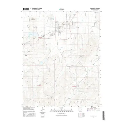
2017 Map of Prairie Grove
USGS Topo · Published 2017About this map
The Prairie Grove area in Washington County exhibits a landscape shaped by the Illinois River and its numerous tributaries, including Muddy Fork and Sulphur Fork. This 2017 survey reveals a collection of small rural centers such as Hogeye, Hubbard, and the outskirts of Farmington, which are connected by a web of county roads and named ridges. The terrain is defined by several prominent peaks, including North Mayberry Mtn, South Mayberry Mtn, and Cane Hill Mtn, which overlook water features like Lake Prairie Grove and Budd Kidd Lake. For family historians, the map is a dense resource for local burial sites, precisely locating the Illinois Chapel Cem, Billingsley Cem, and Rutherford Cem. The presence of Living Waters Spring and Big Spring near the riverbanks highlights the enduring importance of natural water sources in this part of Arkansas.
Find a feature on this map
133 named features on this map. Tap any name to fly to it.
Don’t see what you’re looking for? This feature index may not catch every label — zoom into the map to look around manually.
Map Details
Editions of this 2017 Prairie Grove Map
This is the sole edition of this map. No revisions or reprints were ever made.
Other maps of this area

1898 · Winslow
USGS Topo · 1:125,000

1899 · Fayetteville
USGS Topo · 1:125,000

1901 · Winslow
USGS Topo · 1:125,000

1901 · Fayetteville
USGS Topo · 1:125,000

1904 · Fayetteville
USGS Topo · 1:125,000

1946 · Fort Smith
USGS Topo · 1:250,000

1954 · Tulsa
USGS Topo · 1:250,000

1958 · Fayetteville
USGS Topo · 1:24,000

1958 · Tulsa
USGS Topo · 1:250,000

1963 · Tulsa
USGS Topo · 1:250,000