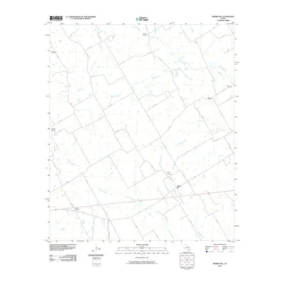
2010 Map of Prairie Hill
USGS Topo · Published 2010About this map
Prairie Hill and the surrounding agricultural landscape of Limestone County are defined by a network of seasonal watercourses and rural burial grounds. The Navasota River flows across the northern reaches, where Archer Bridge provides a key crossing near Grays Branch. The terrain is etched by drainage systems like Christmas Creek and Mustang Creek, which historically dictated the placement of early homesteads and transport routes.
Find a feature on this map
54 named features on this map. Tap any name to fly to it.
Don’t see what you’re looking for? This feature index may not catch every label — zoom into the map to look around manually.
Map Details
Editions of this 2010 Prairie Hill Map
This is the sole edition of this map. No revisions or reprints were ever made.
Other maps of this area

1920 · Mart
USGS Topo · 1:62,500

1954 · Waco
USGS Topo · 1:250,000

1955 · Waco
USGS Topo · 1:250,000

1956 · Hubbard
USGS Topo · 1:24,000

1956 · Penelope
USGS Topo · 1:24,000

1956 · Axtell
USGS Topo · 1:24,000

1956 · Mart
USGS Topo · 1:24,000

1957 · Prairie Hill
USGS Topo · 1:24,000

1957 · Groesbeck
USGS Topo · 1:62,500
1957 · Elk
USGS Topo · 1:24,000