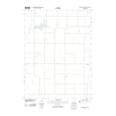
2010 Map of Prairie Rose Lake
USGS Topo · Published 2010About this map
Prairie Rose Lake serves as a central landmark in this rural Iowa landscape, a man-made reservoir held by the Prairie Rose Lake Dam and surrounded by a network of gravel and paved roads. The terrain is defined by the drainage patterns of the East Branch West Nishnabotna River and numerous tributaries such as Walnut Creek and Indian Creek. This area maintains a strong agricultural character, illustrated by the strictly gridded road system including Booth ST and York RD. For those tracing local heritage, the map identifies small, significant points of interest like the settlement of Rorbeck and quiet burial grounds such as Folck Cemetery and Monroe Cemetery, which provide geographical anchors for family history in the region.
Find a feature on this map
30 named features on this map. Tap any name to fly to it.
Don’t see what you’re looking for? This feature index may not catch every label — zoom into the map to look around manually.
Map Details
Editions of this 2010 Prairie Rose Lake Map
This is the sole edition of this map. No revisions or reprints were ever made.
Other maps of this area

1954 · Omaha
USGS Topo · 1:250,000

1957 · Omaha
USGS Topo · 1:250,000

1958 · Omaha
USGS Topo · 1:250,000

1963 · Avoca
USGS Topo · 1:24,000

1971 · Walnut
USGS Topo · 1:24,000

1971 · Atlantic
USGS Topo · 1:24,000

1978 · Elk Horn
USGS Topo · 1:24,000

1978 · Kimballton
USGS Topo · 1:24,000

1978 · Corley
USGS Topo · 1:24,000

1978 · Prairie Rose Lake
USGS Topo · 1:24,000