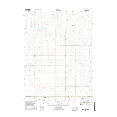
2015 Map of Prairie Rose Lake
USGS Topo · Published 2015About this map
Walnut sits at the southern edge of this Iowa landscape where the borders of Shelby, Pottawattamie, and Cass Counties meet. The terrain is defined by a dense drainage network, including the East Branch West Nishnabotna River and the winding course of Walnut Cr. To the north, Prairie Rose Lake serves as a prominent focal point for the region. The map reveals the strictly gridded agricultural development of the early twenty-first century, punctuated by historical sites such as Folck Cem and Monroe Cem. This survey illustrates how the section-line road system, including routes like RD m47 and Co HWY l34, integrates the rural farmsteads with the regional waterways of Indian Creek and Dutch Br.
Find a feature on this map
41 named features on this map. Tap any name to fly to it.
Don’t see what you’re looking for? This feature index may not catch every label — zoom into the map to look around manually.
Map Details
Editions of this 2015 Prairie Rose Lake Map
This is the sole edition of this map. No revisions or reprints were ever made.
Other maps of this area

1954 · Omaha
USGS Topo · 1:250,000

1957 · Omaha
USGS Topo · 1:250,000

1958 · Omaha
USGS Topo · 1:250,000

1963 · Avoca
USGS Topo · 1:24,000

1971 · Walnut
USGS Topo · 1:24,000

1971 · Atlantic
USGS Topo · 1:24,000

1978 · Elk Horn
USGS Topo · 1:24,000

1978 · Kimballton
USGS Topo · 1:24,000

1978 · Corley
USGS Topo · 1:24,000

1978 · Prairie Rose Lake
USGS Topo · 1:24,000