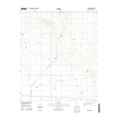
2013 Map of Prairie Spring
USGS Topo · Published 2013About this map
The high desert basin of the Jornada del Muerto dominates this part of Socorro County, where life and transit are defined by the location of scattered water sources and expansive ranching operations. The map details a landscape of strategic water points like Prairie Spring, San Antonio Spring, and Llano Spring, which historically supported movement through this arid stretch. Evidence of the region's ranching heritage is seen at Rancho Ojo del Llano, Muncy Ranch, and Jones Ranch. In the south, the influence of modern government land use is marked by the boundary of the White Sands Missile Range just north of Us-380. Topographic features such as the volcanic Cerro Pardo and the drainage of the San Pedro Arroyo contrast with the largely flat basin floor, while military routes like WSMR S Route 3617 crisscross the terrain.
Find a feature on this map
31 named features on this map. Tap any name to fly to it.
Don’t see what you’re looking for? This feature index may not catch every label — zoom into the map to look around manually.
Map Details
Editions of this 2013 Prairie Spring Map
This is the sole edition of this map. No revisions or reprints were ever made.
Other maps of this area

1916 · La Joya
USGS Topo · 1:125,000

1918 · Oscura Peak
USGS Topo · 1:125,000

1948 · Carthage
USGS Topo · 1:62,500

1948 · Bingham
USGS Topo · 1:62,500

1954 · Tularosa
USGS Topo · 1:250,000

1954 · Socorro
USGS Topo · 1:250,000

1958 · Socorro
USGS Topo · 1:250,000

1958 · Tularosa
USGS Topo · 1:250,000

1962 · Socorro
USGS Topo · 1:250,000
1972 · Bustos Well
USGS Topo · 1:24,000