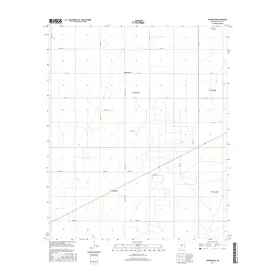
2017 Map of Prairieview
USGS Topo · Published 2017About this map
Prairieview anchors this section of Lea County, New Mexico, where the grid-based settlement of the Llano Estacado is clearly visible. The landscape is characterized by a dense network of secondary roads and lanes, including Collins Rd, Dovey Rd, and Crockett Rd, which serve numerous agricultural and industrial plots. These road names, such as Simpson Rd and Dickenson Ln, often reflect local family legacies or early settlers of the High Plains. Drainage in this arid environment is represented by the ephemeral McKenzie Draw, which cuts across the northeastern corner. The map also records the precise township and range boundaries, such as t14s r37e and t15s r38e, illustrating the systematic division of land that defines the region's historical development and ranching history.
Find a feature on this map
27 named features on this map. Tap any name to fly to it.
Don’t see what you’re looking for? This feature index may not catch every label — zoom into the map to look around manually.
Map Details
Editions of this 2017 Prairieview Map
This is the sole edition of this map. No revisions or reprints were ever made.
Other maps of this area

1954 · Hobbs
USGS Topo · 1:250,000

1954 · Brownfield
USGS Topo · 1:250,000

1958 · Brownfield
USGS Topo · 1:250,000

1958 · Hobbs
USGS Topo · 1:250,000

1962 · Brownfield
USGS Topo · 1:250,000

1962 · Lovington
USGS Topo · 1:24,000

1962 · Lovington
USGS Topo · 1:62,500

1969 · Humble City NE
USGS Topo · 1:24,000

1970 · Prairieview
USGS Topo · 1:24,000

1970 · Prairieview NE
USGS Topo · 1:24,000